BROWSE RECORDS
[ 38 sites ] Click thumbnails to view larger pictures.
| SITE ID - NAME : |
A1 |
Abu Maria |
| ANCIENT NAME : |
Apku, Apqu |
| OTHER NAME : |
Abu Marya, Bumariyah |
| LOCATION : |
North Iraq, Mosul |
| CHRONOLOGY : |
Chalcolithic; Protoliterate; Early Historic; Late Historic |
| PERIOD CODE : |
5 6 8 12 18 |
| DESCRIPTION : |
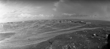
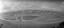
Two large mounds with a spring between them. Mound 1 is ca. 20 m high and it is covered by an extensive modern cemetery. Mound 2 is considerably larger, 25 m high, and marked by the ruins of a rectangular fortified noble's mansion, or khan. In 1938 in a very short (three weeks) season of excavations, led by Lloyd, foremost Neo-Assyrian ceramics, and an Assyrian inscription on a baked brick were found. Generally, the site is identified with ancient Apku, or Apqu. In the 13th century AD Abu Maria had a Christian population. |
| PICTURE : |
|
- 1 -
| SITE ID - NAME : |
A2 |
Afar (Tell) |
| ANCIENT NAME : |
Nimit Ishtar? |
| OTHER NAME : |
- |
| LOCATION : |
North Iraq, Mosul |
| CHRONOLOGY : |
Early Historic; Late Historic |
| PERIOD CODE : |
12 13 14 15 16 17 18 |
| DESCRIPTION : |
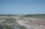
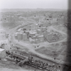
Market town, located between Mosul and the Jebel Sinjar. It had a bishop in the 12th century AD, and it may have had a castle, but there are virtually no medieval buildings anymore. Exceptions are fragments of two round bastions made of stone. One of these was decorated by means of large plastered chevrons, typical of Seljuk architecture (11-14th centuries AD). |
| PICTURE : |
|
- 2 -
| SITE ID - NAME : |
A3 |
Ali Agha |
| ANCIENT NAME : |
- |
| OTHER NAME : |
Gird Ali Agha |
| LOCATION : |
North Iraq, Erbil |
| CHRONOLOGY : |
Neolithic |
| PERIOD CODE : |
3 |
| DESCRIPTION : |
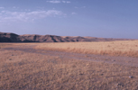
A low mound measuring ca. 80 by 100 m, located along the left bank of the Greater Zab. A small sounding mainly revealed a series of floors, a hearth, a pit, chipped stone tools, a ground stone celt, bone awls, beads, and some female human figurines. The Proto-Hassuna pottery appears to be transitional between that of Jarmo and Hassuna. |
| PICTURE : |
|
- 3 -
| SITE ID - NAME : |
A4 |
Arpachiyah |
| ANCIENT NAME : |
- |
| OTHER NAME : |
- |
| LOCATION : |
North Iraq, Mosul |
| CHRONOLOGY : |
Neolithic; Chalcolithic |
| PERIOD CODE : |
4 5 |
| DESCRIPTION : |
A small site near the Tigris at Nineveh. The 1930's the excavations of Max Mallowan revealed a sequence of ten architectural phases of Ubaid levels (TT 1-4) over Halaf levels (TT6-10), with an intermediate transitional phase. Mallowan found the first examples of the typical Halafian round building: the tholos. Moreover, large numbers of well-made and beautifully painted Halaf pottery were found, especially in the so-called Burnt House of level TT6. Re-investigations in the 1970's by Hijara revealed more levels with rectangular architecture. The excavations at Arpachiyah were at the basis of the division of the Halaf period in Early, Middle and Late phases. |
| PICTURE : |
|
- 4 -
| SITE ID - NAME : |
A5 |
Assur |
| ANCIENT NAME : |
Assur |
| OTHER NAME : |
Ashur, Qal' at Shergat, Qal' at Sherqat |
| LOCATION : |
North Iraq, Mosul |
| CHRONOLOGY : |
Neolithic; Chalcolithic; Protoliterate; Early Historic; Late Historic |
| PERIOD CODE : |
4 5 6 7 8 9 10 11 12 13 14 15 16 |
| DESCRIPTION : |
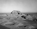
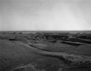
Ancient centre of Assyria near the Tigris river, marked by both public and residential architecture. Much of the public architecture was built under the reign of Shamsi-Adad I (1813-1781 BC), including the ziggurat (= temple tower) of Enlil, the temple of Assur, and the city walls. Later Middle and Neo-Assyrian kings added to these buildings, providing the city with three ziggurats and at least 38 temples (e.g. the temple of Ishtar) within the 140 ha contained by the city walls. Besides religious architecture the city contained at least two palaces. The 'new palace' was constructed by Tukulti-Ninurta I (1243-1207 BC). In the ninth century the 'old palace' became a mausoleum, with sarcophagi of the kings Assurnasirpal II, and Shamsi-Adad V. Many clay tablets have been recovered from official buildings and private houses. |
| PICTURE : |
|
- 5 -
| SITE ID - NAME : |
B1 |
Babylon |
| ANCIENT NAME : |
Babylon |
| OTHER NAME : |
includes modern sites Babil (Mujelibah), Kasr, Amran Ibn Ali, Homera, Markaz (Merkes) |
| LOCATION : |
Central Iraq, Hillah |
| CHRONOLOGY : |
Early Historic; Late Historic |
| PERIOD CODE : |
10 11 12 13 14 15 16 17 18 |
| DESCRIPTION : |
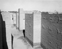
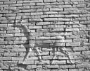
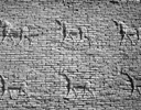
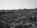
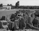
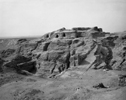
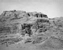
This perhaps most famous archaeological site in the world is located along a branch of the Euphrates south of Baghdad. After early explorations by others, Koldewey conducted large-scale German excavations in 1899-1977. More recently, Iraqi and Italian expeditions have worked at the site. Babylon was the political centre of southern Mesopotamia, especially during the Old Babylonian (2000-1600 BC) and Neo-Babylonian (625-539 BC) periods, when it was the seat of empires of respectively Hammurabi and Nebuchadnezzar (Babylonia). During the 2nd and 1st millennia the city remained important, and served as the regional capital of invading empires in Neo-Assyrian and Achaemenid periods (Alexander the Great died in the city). Babylon is especially famous for its wonderful and well-preserved monuments, e.g. the Ishtar gate (with beautiful glazed friezes of animals), the temple-tower or ziggurat (the 'Tower of Babel'), and the palace of Nebuchadnezzar (with perhaps one of the seven Wonders of the World: the 'Hanging Gardens' of Babylon). The city was destroyed during the reign of the Neo-Assyrian king Sennacherib. |
| PICTURE : |

|
- 6 -
| SITE ID - NAME : |
B3 |
Baiji |
| ANCIENT NAME : |
- |
| OTHER NAME : |
- |
| LOCATION : |
North Iraq, Baghdad |
| CHRONOLOGY : |
? |
| PERIOD CODE : |
|
| DESCRIPTION : |
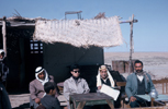
Modern town on the road from Mosul to Iraq. Not excavated; no further archaeological information. |
| PICTURE : |
|
- 7 -
| SITE ID - NAME : |
B5 |
Balawat |
| ANCIENT NAME : |
Imgur Enlil |
| OTHER NAME : |
- |
| LOCATION : |
North Iraq, Mosul |
| CHRONOLOGY : |
Early Historic |
| PERIOD CODE : |
12 |
| DESCRIPTION : |
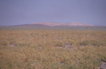
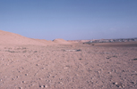
A 60 ha walled Neo-Assyrian town with a 3 ha citadel near the Upper Zab river. Re-founded by the king Assurnasirpal II as a 'country retreat'. Work in the 1880's (digging tunnels...) revealed the so-called Balawat bronze doors in a temple dedicated to Mamu, the god of dreams. The depictions on the doors narrate and illustrate military campaigns of Assurnasirpal I and his successor Shalmaneser III. In the 1950's Mallowan found at least two more pairs of similarly ornamented gates from the time of an earlier king, Ashunasirpal II (883-559 BC). The Mamu temple contained a small archive with clay tablets. |
| PICTURE : |
|
- 8 -
| SITE ID - NAME : |
B6 |
Billa (Tell) |
| ANCIENT NAME : |
Shibaniba, ヤibaniba |
| OTHER NAME : |
Billah |
| LOCATION : |
North Iraq, Mosul |
| CHRONOLOGY : |
Chalcolithic; Protoliterate, Early Historic; Late Histric |
| PERIOD CODE : |
5 6 8 12 18 |
| DESCRIPTION : |
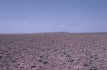
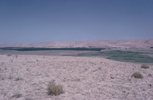
Located ca. 12 km southeast of Khorsabad, this tell measures about 600x500 m. Small-scale excavations in the 1930's revealed various deposits, but the site is best-known for its possible administrative Middle Assyrian archive. Here were found 67 clay tablets dating to the reigns of Shalmaneser I (1273-1244 BC) and Tukulti-Ninurta I (1243-1207 BC). At another area of the site about 15 clay tablets were unearthed from a Neo-Assyrian archive. Most of the texts date to 853-826 BC; the reign of Shalmaneser III. Apart from these archives, attractive Mitanni painted pottery of the 15th-14th centuries BC was found. |
| PICTURE : |
|
- 9 -
| SITE ID - NAME : |
C1 |
Ctesiphon |
| ANCIENT NAME : |
Taq-i-Kasra |
| OTHER NAME : |
Salman Pak, Taq Kisra, includes the sites Ma' aridh, Al, Zaatir, Umm al, Dhaha |
| LOCATION : |
Central Iraq, Baghdad |
| CHRONOLOGY : |
Late Historic |
| PERIOD CODE : |
16 17 18 |
| DESCRIPTION : |
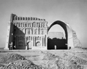
This magnificent site, not far from Baghdad, was one of the great cities of ancient Mesopotamia and the capital of the Iranian Parthian empire (Arsacid dynasty) and its successor, the Sassanid Persian empire, for more than 600 years. Under king Mithradates (ca. 171-138 BC) Mesopotamia was conquered and ruled by the dynasty for more than three centuries. At its heyday the site measured 30 km_. The city was captured five times by Roman or Byzantine forces. Eventually, the city fell to the Islamic Saracens in AD 637 and thereafter went into a rapid decline. The enormous vaulted arch (Taq Kisra; the main portico of the audience hall of the Sassanians) is now all that remains of the city. |
| PICTURE : |

|
- 10 -
| SITE ID - NAME : |
E1 |
El Khan |
| ANCIENT NAME : |
- |
| OTHER NAME : |
al-Khan |
| LOCATION : |
North Iraq, Mosul |
| CHRONOLOGY : |
Neolithic |
| PERIOD CODE : |
3 |
| DESCRIPTION : |
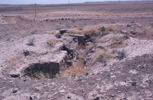
Standard or Late Hassuna site located on the west bank of the Khazir river, just south of M'lefaat. Pottery sherds include painted, incised, and painted+incised Hassuna types, including so-called husking trays and milk jars. |
| PICTURE : |
|
- 11 -
| SITE ID - NAME : |
E2 |
Eridu |
| ANCIENT NAME : |
Eridu |
| OTHER NAME : |
Abu Shahrain |
| LOCATION : |
South Iraq, Basra |
| CHRONOLOGY : |
Chalcolithic; Protoliterate; Early Historic; Late Historic |
| PERIOD CODE : |
5 6 7 8 9 10 11 12 13 14 |
| DESCRIPTION : |
According to Sumerian mythology, the oldest city in southern Mesopotamia. Excavations by Safar and Lloyd in the 1940's revealed a long sequence of Ubaid and Uruk deposits. Buildings of these periods document the development of tri-partite architecture. Traditionally, these structures were reconstructed as temples, but recently the buildings have been interpreted as elite residences, or audience halls. Ubaid levels provided evidence of a large cemetery. By the end of the Ubaid period the town measured some 12 ha. The early deposits are covered by Sumerian Early Dynastic remains, including a palace, and a ziggurat (= temple tower) of the Ur III period (last century of the 3rd millennium).
|
| PICTURE : |

|
- 12 -
| SITE ID - NAME : |
G1 |
Gawra (Tepe) |
| ANCIENT NAME : |
- |
| OTHER NAME : |
- |
| LOCATION : |
North Iraq, Mosul |
| CHRONOLOGY : |
Chalcolithic; Early Historic |
| PERIOD CODE : |
4 5 11 |
| DESCRIPTION : |
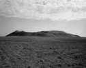
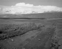
Located east of the Tigris near Khorsabad. The lowest levels of this tell reveal a transition between the Halaf and Ubaid periods, followed by a long-lasting Ubaid settlement. One of the best-known features is a temple complex (Gawra XIII), which resembles the Ubaid 'temples' at Eridu and Uruk. Later occupation levels were marked by a large round house and various 'temples'. Later levels belong to the 3d and 2nd millennia BC, terminating in a Mitanni settlement. |
| PICTURE : |
|
- 13 -
| SITE ID - NAME : |
G2 |
Gird Chai |
| ANCIENT NAME : |
- |
| OTHER NAME : |
- |
| LOCATION : |
North Iraq, Erbil |
| CHRONOLOGY : |
Paleolithic |
| PERIOD CODE : |
1 |
| DESCRIPTION : |
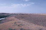
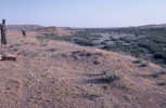
Located on a terrace near the Greater Zab river. Limited excavations revealed a flint assemblage reminiscent of Upper Paleolithic Zawi Chemi Shanidar and Karim Shahir, located ca. 50 km to the northeast. Bladelets, notched pieces and microlithic elements are predominant in the assemblage. Small numbers of ground stone tools and chipped celts were found as well. |
| PICTURE : |
|
- 14 -
| SITE ID - NAME : |
H2 |
Hassuna (Tell) |
| ANCIENT NAME : |
- |
| OTHER NAME : |
- |
| LOCATION : |
North Iraq, Mosul |
| CHRONOLOGY : |
Neolithic; Chalcolithic; Early Historic |
| PERIOD CODE : |
3 5 12 |
| DESCRIPTION : |
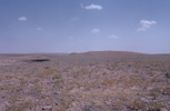
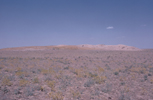
In the 1940's excavations of this site near the confluence of the Upper Zab by Lloyd and Safar resulted in the definition of the Hassuna culture complex. The 17 levels fall into four cultural phases. The first, deepest, level is marked by ephemeral occupation of a perhaps semi-sedentary community whose material culture is largely similar to that found at Umm Dabaghiyah. Following are levels of respectively 'Archaic Hassuna' and 'Standard Hassuna', marked by simple rectangular multi-roomed architecture and rather coarse pottery. The Hassuna deposits are covered by five Halaf and three Ubaid levels, on their turn capped by much later deposits. |
| PICTURE : |
|
- 15 -
| SITE ID - NAME : |
H3 |
Hatra |
| ANCIENT NAME : |
- |
| OTHER NAME : |
Al Hadr |
| LOCATION : |
North Iraq, Mosul |
| CHRONOLOGY : |
Late Historic |
| PERIOD CODE : |
16 17 |
| DESCRIPTION : |
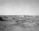
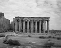
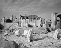
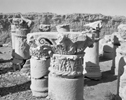
Parthian city near the Wadi Tharthar in northern Iraq. The site is round, 320 ha in size and surrounded by two concentric walls. Located in its centre was a large administrative complex and a group of temples. The most important is the temple dedicated to the Shamash or Sun God; other heavenly bodies had temples of their own. The group of temples has been partly restored and exemplifies the unique Hatran architecture: an elegant combination of eastern and western influences. A large palace was situated near the north gate. In the south and east were two mausolea. Apparently, this isolated city was mainly engaged in caravan trade. It defended itself successfully against Roman attacks, but fell to the rising power of the Sassanian rulers (Shapur 1) in AD 240. Hatra is well-known for its large stone human Parthian sculpture, among which is a beautiful statue of Sanatruq II. |
| PICTURE : |
|
- 16 -
| SITE ID - NAME : |
J1 |
Jarmo |
| ANCIENT NAME : |
- |
| OTHER NAME : |
- |
| LOCATION : |
North Iraq, Kirkuk |
| CHRONOLOGY : |
Neolithic |
| PERIOD CODE : |
2 3 |
| DESCRIPTION : |
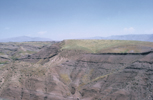
A small (ca. 1.3 ha) Aceramic to Ceramic Neolithic site in the Zagros foothills of northwestern Iraq. The settlement was the focus of Robert Braidwood's interdisciplinary project on the incipience of agriculture and domestication in the 1950's. A total of 16 levels have been excavated. The material culture shows no major transformations throughout the period of occupation, with the exception of the appearance of pottery in the later levels. Architecture mainly consisted of simple rectangular structures consisting of small rooms built of pisé. Especially numerous among the finds were clay figurines of humans and animals; of which 5500 were recovered. Faunal and botanical remains indicate a gradual shift
in emphasis from wild to domestic species. |
| PICTURE : |

|
- 17 -
| SITE ID - NAME : |
K1 |
Karim Shahir |
| ANCIENT NAME : |
- |
| OTHER NAME : |
- |
| LOCATION : |
North Iraq, Kirkuk |
| CHRONOLOGY : |
Paleolithic |
| PERIOD CODE : |
1 |
| DESCRIPTION : |
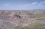
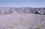
Open air site situated in the Central Zagros, 2 km northeast of Jarmo. Chronologically, the site is to be placed in the Early Holocene Upper Paleolithic, ca. 10,000-7250 BC. The site is of the same cultural tradition as Shanidar and Zawi Chemi Shanidar to the north. Large numbers of chipped stone tools and debris were excavated, mainly blades, flakes, notched pieces, scrapers, backed blades and some microliths. Clearly, these people were hunter-gatherers, but with regard to the earlier Paleolithic periods, finds such as possible dwelling floors, a stone living surface, a pit with red ochre, items of clay shell and bone, and stone ornaments indicate increasing economic and cultural sophistication. |
| PICTURE : |
|
- 18 -
| SITE ID - NAME : |
K2 |
Khorsabad |
| ANCIENT NAME : |
Dur Sharrukin, Dur-_arrukin |
| OTHER NAME : |
- |
| LOCATION : |
North Iraq, Mosul |
| CHRONOLOGY : |
Early Historic |
| PERIOD CODE : |
12 |
| DESCRIPTION : |
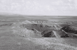
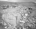
Situated about 20 km north of Nineveh. A short-lived capital of Assyria. It was built over an existing village by the Neo-Assyrian king Sargon II (721-705 BC) as a new capital north of Nineveh. It was used as a fortified place by his successors. The nearly square walls of Sargon's city enclosed roughly 325 ha! A citadel with a palace complex and arsenal formed separate compounds in the city walls. The Nabu temple and houses for high-ranking persons were located on a somewhat lower level. In Sargon's palace fabulous series of wall reliefs and monumental sculpture, including winged human-headed bulls, were discovered. Unfortunately, much of these objects were lost in the Euphrates while being transported to France... |
| PICTURE : |
|
- 19 -
| SITE ID - NAME : |
K3 |
Kirkuk |
| ANCIENT NAME : |
Arrapah |
| OTHER NAME : |
Kerkuk, Qal'a |
| LOCATION : |
North Iraq, Kirkuk |
| CHRONOLOGY : |
Early Historic; Late Historic |
| PERIOD CODE : |
10 12 18 |
| DESCRIPTION : |
Located 16 km northeast of Nuzi, near the Khasa river. The modern city Kirkuk covers the ancient tell. Since Adad Nirari II (911-891 BC), this city belonged to the Assyrian empire. Arrapah was the capital of a state that included both Nuzi and Kurruhanni. It was strongly influenced by Hurrian and Babylonian developments. In 1912 a total of 144 clay tablets were found at an eroded part of the tell. |
| PICTURE : |

|
- 20 -
| SITE ID - NAME : |
K4 |
Kish |
| ANCIENT NAME : |
- |
| OTHER NAME : |
includes the sites Al Uhaimer and Ingharra |
| LOCATION : |
Central Iraq, Hillah |
| CHRONOLOGY : |
Protoliterate; Early Historic; Late Historic |
| PERIOD CODE : |
5 6 7 8 9 10 11 12 13 14 15 16 17 |
| DESCRIPTION : |
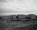
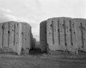
An important Sumerian (Early Dynastic) city on a former channel of the Euphrates. The site is composed of several separate large mounds that together define an occupation sequence from the Ubaid to medieval times. The most important discoveries of the Early Dynastic phases are the 'Y settlement', with rich burials (including cart burials comparable to those at Ur and Susa), and the 'A complex', consisting of a palace, ziggurat (= temple tower) and a cemetery. Kish plays a pivotal role in 3rd millennium textual sources, which present us with vivid descriptions of rivalry between competing city-states. Of the post-Early Dynastic occupation, the Neo-Babylonian temple constructed by Nebuchadnezzar is best known, as its walls still stand to a height of ca. 6 m. |
| PICTURE : |
|
- 21 -
| SITE ID - NAME : |
M1 |
Matarrah |
| ANCIENT NAME : |
- |
| OTHER NAME : |
- |
| LOCATION : |
North Iraq, Kirkuk |
| CHRONOLOGY : |
Neolithic; Chalcolithic |
| PERIOD CODE : |
3 4 5 |
| DESCRIPTION : |
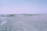
A largely Hassunan village of ca. 200 m in diameter and 8 m high, located south of Kirkuk. In 1948 Braidwood discovered houses consisting of small rooms, separated by alleys and open spaces. Possibly, parts of the characteristic Samarran T-shaped buildings (as found at Sawwan) were revealed. The appearance of painted Samarra pottery in upper parts of the sequence have proved useful for reconstructing interactions between Hassuna and Samarra communities. |
| PICTURE : |

|
- 22 -
| SITE ID - NAME : |
M2 |
Mezra |
| ANCIENT NAME : |
- |
| OTHER NAME : |
Mezrah, Mizra, Mizrah, Qara Tepe, Quara Tappah |
| LOCATION : |
North Iraq, Mosul |
| CHRONOLOGY : |
Neolithic; Chalcolithic; Protoliterate |
| PERIOD CODE : |
4 5 8 |
| DESCRIPTION : |
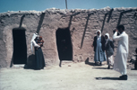
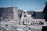
A large tell consisting of two mounds of about 30 m (!) height. Smaller mounds are located to the south. Only very limited numbers of pottery on the surface. |
| PICTURE : |
|
- 23 -
| SITE ID - NAME : |
M3 |
M’lefaat |
| ANCIENT NAME : |
- |
| OTHER NAME : |
M' Lefat |
| LOCATION : |
North Iraq, Mosul |
| CHRONOLOGY : |
Neolithic |
| PERIOD CODE : |
2 |
| DESCRIPTION : |
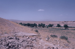
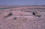
A low mound measuring 125 by 75 m. A total of ten round/oval houses, some built of the earliest known bricks from Mesopotamia, have been excavated. The houses, up to 6 m in diameter and sometimes semi-subterranean, stood around a large open area used for communal domestic activities. The houses have been radiocarbon dated to 8300 BC. The subsistence was based on hunting and gathering. |
| PICTURE : |
|
- 24 -
| SITE ID - NAME : |
N1 |
Nimrud |
| ANCIENT NAME : |
Kalhu |
| OTHER NAME : |
- |
| LOCATION : |
North Iraq, Mosul |
| CHRONOLOGY : |
Early Historic; Late Historic |
| PERIOD CODE : |
11 12 16 |
| DESCRIPTION : |
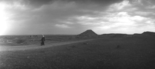
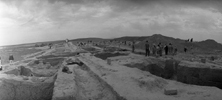
Imperial Assyrian city south of Nineveh, best known for the extensive excavations on the citadel (Nimrud) and arsenal ('Fort Shalmaneser') conducted by Layard and Mallowan. Nimrud was established as the imperial seat by Assurnasirpal II (883-859 BC). Later Assyrian kings also built extensively in the city. Sargon II (721-705 BC) moved the imperial seat to Khorsabad; after this time Nimrud (Kalhu) was the capital. The rectangular city walls enclosed an area of ca. 360 ha. Apart from the citadel, including a ziggurat, and arsenal, a massive temple-palace and administrative buildings were detected. Nimrud is especially known for its fine art objects, including large stone sculpture, but also small treasures such as superbly carved ivories, gold jewellery, glass objects, etc., many of which found in vaulted tombs. Moreover, large numbers of cuneiform tablets have been recovered from both official buildings and private houses. |
| PICTURE : |


|
- 25 -
| SITE ID - NAME : |
N2 |
Nineveh |
| ANCIENT NAME : |
- |
| OTHER NAME : |
Kuyunjik, Nebi Yunus |
| LOCATION : |
North Iraq, Mosul |
| CHRONOLOGY : |
Neolithic; Protoliterate; Early Historic |
| PERIOD CODE : |
3 6 8 12 |
| DESCRIPTION : |
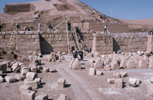
A huge, 750 ha, walled largely Neo-Assyrian city. As was standard in Assyrian cities (see Nimrud), the city was marked by separate citadel and arsenal compounds. Most archaeological attention has been paid to the citadel (Kuyunjik), where the palaces of Sennacherib (704-681 BC) and Assurbanipal (668-627 BC) were uncovered. Mallowan made a deep sounding at the Ishtar temple, revealing a long sequence starting with the Hassuna period, and defining the famous Early Dynastic 'Ninivite 5' painted pottery style (ca. 2900-2500 BC). A wealth of Neo-Assyrian art has been recovered from Nineveh, including a series of magnificent alabaster reliefs with fighting and hunting scenes from the North Palace of Assurbanipal. Moreover, the large number of clay tablets found in the monumental buildings during the early excavations (1842-1932), especially of 'Assurbanipal's Library', contributed to the rise of Assyriology at the end of the nineteenth century AD. |
| PICTURE : |
|
- 26 -
| SITE ID - NAME : |
N3 |
Nuzi |
| ANCIENT NAME : |
Gasur (Old Akkadian name) |
| OTHER NAME : |
Yorghan (Tepe), Yorgan (Tepe) |
| LOCATION : |
North Iraq, Kirkuk |
| CHRONOLOGY : |
Neolithic; Chalcolithic; Protoliterate; Early Historic; Late Historic |
| PERIOD CODE : |
3 4 5 6 7 8 9 10 11 12 13 14 15 16 17 |
| DESCRIPTION : |
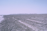
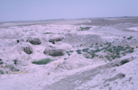
A small (4 ha) site near Kirkuk. Many of the early levels at the site are poorly understood, but the site is important because of its collection of Old Akkadian (Mitanni) texts of the 23rd century BC, and the extensive exposure of mid 2nd-millennium (Old Assyrian) occupation associated with the kingdom of Arrapha and with the Mitanni. During this period the site was marked by a citadel with a palace and a temple, surrounded by private houses. Many clay texts have been recovered from different archives in these different buildings. It seems that Hurrian was the spoken language. Nuzi is especially well-known for its 'Nuzi Ware': a style of painted pottery that was widely distributed in mid 2nd-millennium western Asian sites. |
| PICTURE : |
|
- 27 -
| SITE ID - NAME : |
Q1 |
Qurna |
| ANCIENT NAME : |
- |
| OTHER NAME : |
- |
| LOCATION : |
South Iraq, Basra |
| CHRONOLOGY : |
? |
| PERIOD CODE : |
|
| DESCRIPTION : |
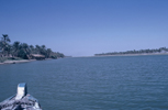
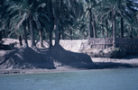
The Euphrates and Tigris join each other at Qurnah, where some Arab legends locate the biblical Garden of Eden. The Sumerians called the fabulous garden of Dilmun, Guggirinna (Qurnah?). On the basis of this it has recently been suggested that Qurnah is Dilmun (or Telmun). Dilmun is traditionally associated with ancient sites on the islands of Bahrain in the Persian Gulf. Because of its location along the sea trade routes, linking Mesopotamia with the Indus Valley Civilization, Dilmun developed in the Bronze Age, from ca. 3000 BC, into one of the greatest trade centres of the ancient world. |
| PICTURE : |
|
- 28 -
| SITE ID - NAME : |
R1 |
Rutba |
| ANCIENT NAME : |
- |
| OTHER NAME : |
- |
| LOCATION : |
West Iraq, Ramadi |
| CHRONOLOGY : |
Paleolithic; Neolithic |
| PERIOD CODE : |
1 2 |
| DESCRIPTION : |
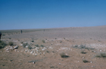
Open air Middle Paleolithic (ca. 100,000-40,000 BC) and Neolithic site near the Wadi Hauran in the desert near the Jordanian border. The site is marked by stone tools. The Middle Paleolithic artefacts consist of cores, some shaped according to the Levallois technique, retouched pieces and unretouched flakes and blades. The Neolithic tools are part of the Wualian tradition, nowadays more often designated as 'burin sites' (typical of the Palmyra Basin, the Azraq Basin and the Black Desert in eastern Jordan). Probably these sites are largely Aceramic, but continuation in the Ceramic Neolithic is probable. Burins were most numerous, but in addition some cores, retouched pieces (e.g. truncations and scrapers) and unretouched flakes and blades were found. |
| PICTURE : |

|
- 29 -
| SITE ID - NAME : |
S1 |
Samarra |
| ANCIENT NAME : |
- |
| OTHER NAME : |
- |
| LOCATION : |
Central Iraq, Baghdad |
| CHRONOLOGY : |
Neolithic; Chalcolithic; Protoliterate; Early Historic; Late Historic |
| PERIOD CODE : |
3 4 5 6 7 8 9 10 11 12 13 14 15 16 17 18 |
| DESCRIPTION : |
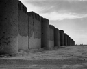
An Early Islamic city of the Abbasid Dynasty (mid 8th-mid 10th century AD: a 'golden age' of Islamic civilization), founded as the new capital in AD 836 near the Tigris north of Baghdad. Most famous among its many monuments is the wonderful spiral minaret of Mutawakkil's great Congregational Mosque. Apart from its importance for the Islamic period, the site was marked by fine painted Neolithic pottery found in a cemetery with human inhumations. These ceramics gave their name to the Samarra culture complex. |
| PICTURE : |

|
- 30 -
| SITE ID - NAME : |
S2 |
Sotto (Tell) |
| ANCIENT NAME : |
- |
| OTHER NAME : |
Satto |
| LOCATION : |
North Iraq, Mosul |
| CHRONOLOGY : |
Neolithic |
| PERIOD CODE : |
3 |
| DESCRIPTION : |
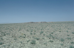
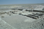
Located at the northern edge of the Mesopotamian plain, this mound is only 2.5 m high and covers about 2 ha. It is partly contemporary with Umm Dabaghiyah, located to the south. The earliest occupation seems to be represented by semi-subterranean dwellings such as found at M'lefaat and Qermez Dere. In Later, Pottery Neolithic, levels, however rectangular buildings were uncovered. Nine burials were placed under housefloors, or adjacent to houses. The architecture, objects and animals and plant remains indicate that Sotto (as it is commonly known) was a small farming village. |
| PICTURE : |
|
- 31 -
| SITE ID - NAME : |
S4 |
Sinjar |
| ANCIENT NAME : |
- |
| OTHER NAME : |
Balad Sinjar |
| LOCATION : |
North Iraq, Mosul |
| CHRONOLOGY : |
Early Historic; Late Historic |
| PERIOD CODE : |
11 12 13 14 15 16 17 18 |
| DESCRIPTION : |
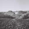
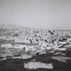
Roman strongholds like Singara (Sinjar) in northern Mesopotamia strengthened defenses against Persian incursions, and ensured that the Persian capital remained vulnerable to Roman thrusts down the valleys of the Euphrates or Tigris Rivers. Parts of the Roman city wall are still visible. The two principal medieval monuments are the shrine of the Lady Zainab, and the ruined minaret of the madrasha of Sultan Kutb ad-Din. Apart from these structures, remnants of houses and tombs are present. |
| PICTURE : |
|
- 32 -
| SITE ID - NAME : |
T2 |
Thalathat (Telul eth-) |
| ANCIENT NAME : |
- |
| OTHER NAME : |
- |
| LOCATION : |
North Iraq, Mosul |
| CHRONOLOGY : |
Neolithic; Chalcolithic; Protoliterate; Early Historic |
| PERIOD CODE : |
3 4 5 6 8 9 10 11 |
| DESCRIPTION : |
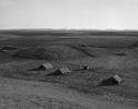
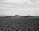
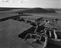
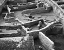
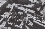
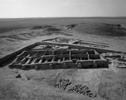
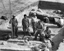
Located ca. 55 km to the west of the modern city of Mosul. Despite its name ('the three mounds'), Telul eth-Thalathat comprises four large tells (I-IV) and one small mound (V). Three of the tells, Thalathat I, II and V, were extensively excavated in the 1950's to the 1970's by the Tokyo University Iraq-Iran Archaeological Expedition. The main occupation of the mounds can be assigned to the 7th to the 2nd millennia BC. Thalathat II, the lowest mound, was mainly occupied from the Proto-Hassuna (or Sotto-Umm Dabaghiyah) to the Uruk (Gawra) periods, with a break in the Halaf period. Occupation at Thalathat V was more limited, as it was mainly occupied in the Early Dynastic (Ninivite 5) period. Thalathat I, the largest mound rising over 20 m from the surrounding surface, has revealed Akkadian and Old Assyrian remains, but earlier occupations certainly exist. |
| PICTURE : |

|
- 33 -
| SITE ID - NAME : |
U1 |
Umm Dabaghiyah |
| ANCIENT NAME : |
- |
| OTHER NAME : |
- |
| LOCATION : |
North Iraq, Mosul |
| CHRONOLOGY : |
Neolithic |
| PERIOD CODE : |
3 |
| DESCRIPTION : |
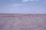
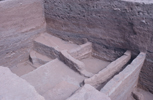
A small prehistoric site that has provided the first indications of pre-Hassuna occupation in Mesopotamia. Kirkbride's excavations revealed a series of small rooms arranged in long blocks around a central open space. Some domestic animals were kept, but the people especially relied on hunting, in particular of wild ass or onager, which are also depicted on wall paintings. The domesticated cereal present were probably imported (perhaps exchanged for animal skins), as the region is not suited for dry farming. The pottery of the site (painted, incised, burnished and plan wares) resembles 'Archaic' Hassuna ceramics, as also found at Tell Sotto and Telul eth-Thalathat. |
| PICTURE : |
|
- 34 -
| SITE ID - NAME : |
U3 |
Ur |
| ANCIENT NAME : |
- |
| OTHER NAME : |
Al Muqayyar (Tell) |
| LOCATION : |
South Iraq, Basra |
| CHRONOLOGY : |
Chalcolithic; Protoliterate; Early Historic |
| PERIOD CODE : |
5 6 7 8 9 10 11 12 13 14 |
| DESCRIPTION : |
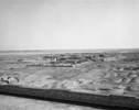
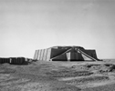
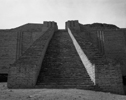
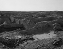
Occupation of this famous South Mesopotamian (Sumerian) site began in Ubaid times when the town expanded up to 10 ha. It further grew in size and importance in the 3rd millennium (the Sumerian period), reaching 50 ha by the Early Dynastic III period. In the last part of the 3rd millennium the city was the ceremonial centre of the Ur III empire which briefly controlled much of Mesopotamia and adjacent zones of the Zagros. After this period the city gradually lost its leading political, economic and ritual role. Many important discoveries have been made at this site, e.g. a royal cemetery, the huge ziggurat (= temple tower) of the moon god Nanna/Sin (the best preserved ziggurat in Mesopotamia), other 3rd millennium religious architecture in the great Temenos or sacred enclosure. Moreover, a rich assemblage of texts has been recovered. The Royal Cemetery and the nearby great Death Pit revealed world famous treasures made of precious materials such as gold, silver, lapis lazuli and shell, including a magnificently decorated 'standard' with a 'peace side', depicting a royal banquet and a 'war side' with Sumerian soldiers and prisoners. Other finds include a statue of a ram standing against a tree or shrub, helmets, daggers, beakers, etc. |
| PICTURE : |
|
- 35 -
| SITE ID - NAME : |
U4 |
Uruk |
| ANCIENT NAME : |
Uruk, Eanna, Kullab |
| OTHER NAME : |
Warka |
| LOCATION : |
South Iraq, Diwaniya |
| CHRONOLOGY : |
Chalcolithic; Protoliterate; Early Historic; Late Historic |
| PERIOD CODE : |
7 8 9 10 11 12 13 14 15 16 17 |
| DESCRIPTION : |
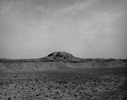
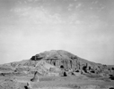
This famous South Mesopotamian site was most important during the Late Uruk to Early Dynastic times (i.e. the Sumerian period), when it grew to cover about 400 ha, and was a major political centre. In Sumerian literature it is associated with the name of Gilgamesh, one of the Early Dynastic rulers credited today with having been an actual historical character. Archaeological explorations have concentrated on two temple precincts, the Eanna precinct and the Anu ziggurat (= temple tower). These areas gave evidence of impressive monumental architecture, e.g. ziggurats, and various temples, among which White Temple and the Pillar Hall. Furthermore, among other things, the palace of Sinkasid (early 2nd millennium), the Karraindash temple (Kassite period), and the Gareus (Parthian) have been investigated. An especially famous find is a superbly carved and extremely lifelike head of a women made from white marble, found in the Eanna precinct and dating to the Ur III period. Moreover, from the Eanna precinct alone at least 10,000 clay tablets have been recovered.
|
| PICTURE : |
|
- 36 -
| SITE ID - NAME : |
Y1 |
Yarim (Tepe) |
| ANCIENT NAME : |
- |
| OTHER NAME : |
- |
| LOCATION : |
North Iraq, Mosul |
| CHRONOLOGY : |
Neolithic |
| PERIOD CODE : |
3 4 5 11 |
| DESCRIPTION : |
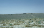
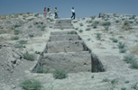
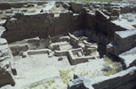
Yarim tepe refers to six distinct tells alongside the Abra river in the Sinjar region in northern Iraq. Soviet excavations from 1969 to the 1980's produced long Neolithic sequences for Yarim Tepe I, II and III. Yarim Tepe I is mainly related to the Hassuna periods (Archaic and Standard Hassuna), with some Samarra, Halaf, and much later Sassanid remains. Yarim Tepe II also has Hassuna layers of occupation, but most of the sequence belongs to the Middle Halaf period, as indicated by circular tholoi, painted pottery and small finds. Thin Ubaid deposits have also been recovered. Yarim Tepe III, the largest of the six mounds, yielded well-preserved Late Halaf structures (mainly round buildings, or tholoi) and up to 4 m thick Ubaid deposits. |
| PICTURE : |

|
- 37 -
| SITE ID - NAME : |
Z1 |
Zarzi |
| ANCIENT NAME : |
- |
| OTHER NAME : |
- |
| LOCATION : |
North Iraq, Sulaimaniya |
| CHRONOLOGY : |
Paleolithic |
| PERIOD CODE : |
1 |
| DESCRIPTION : |
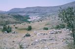
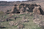
A cave in southern Kurdistan in western Iraq. At this site investigations of Garrod in 1928 provided the definition of the Epipaleolithic Zarzian industry, of which the Shanidar cave near Erbil is another example. The Zarzian, dating to ca. 10,500-6000 BC, is marked by high proportions of backed bladelets, a variety of geometric microliths and notched blades. |
| PICTURE : |
|
- 38 -
PAGE TOP


