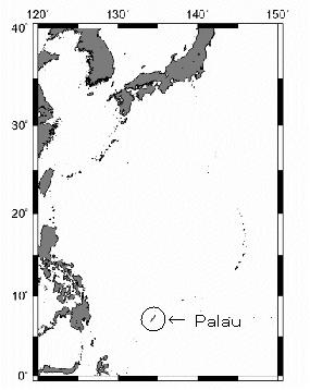
Palau(パラオ)
| 【調査日時】 | 1991年X月XX日~X月XX日 |
|---|---|
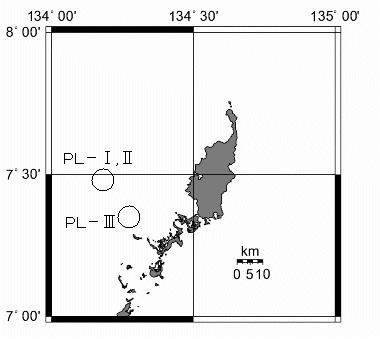
| 【採集地点】 | PL-Ⅰ,PL-Ⅱ,PL-Ⅲ |
| 【調査位置】 | 7°22′N, 134°21′E |
| 【発表論文】 | Kayanne H., Yamano H., Randall RH.(2002) Holocene sea-level changes and barrier reef formation on an oceanic island, Palau Islands, western Pacific Sedimentary Geology. Vol.150, 47-60 |
| 【コア写真】 | PL-Ⅰ-0-5m , PL-Ⅰ-5-10m , PL-Ⅰ-10-15m , PL-Ⅰ-15-20m , PL-Ⅰ-20-25m , PL-Ⅱ-0-5m , PL-Ⅱ-5-10m , PL-Ⅱ-10-15m , PL-Ⅱ-15-20m , PL-Ⅱ-20-25m , PL-Ⅲ-0-5m , PL-Ⅲ-5-10m , PL-Ⅲ-10-15m , PL-Ⅲ-15-20m , PL-Ⅲ-20-25m , PL-Ⅲ-25-30m |
| 【コア柱状図】 | |
| 【年代測定図】 |