CHAPTER II THE SITE
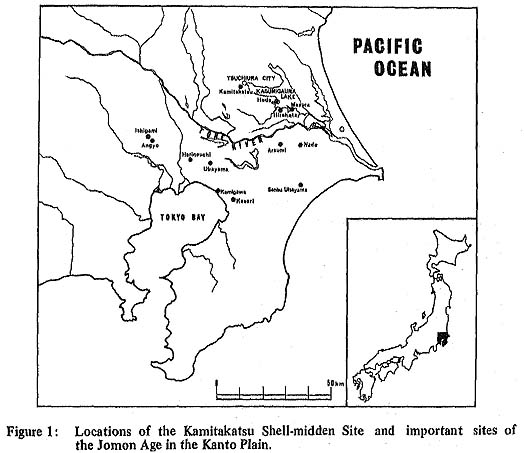
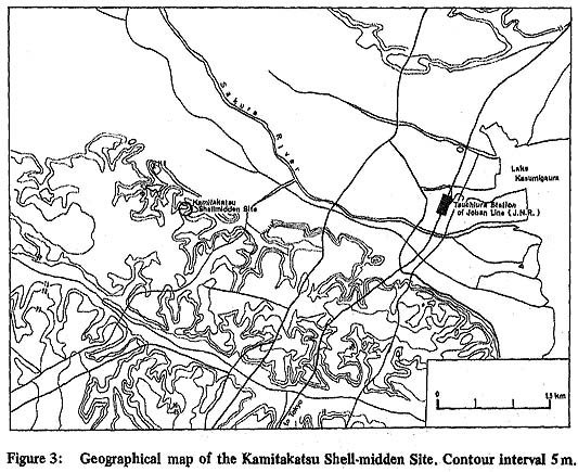
1. Location of the Site and History of the ResearchThe Kamitakatsu Site is located at Kamitakatsu on the outskirts of Tsuchiura City, Ibaragl Prefecture (Figs. 1, 3). The site is situated about 3.7 km. west of J.N.R. Tsuchiura Station (Joban Line). It is on the right bank about seven km up the Sakura River from Kasumigaura Lake.
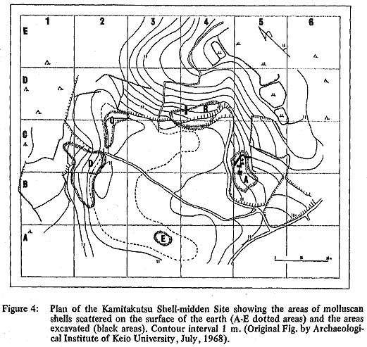
The site sits on a Pleistocene terrace which is covered by the Shimosueyoshi Loam (Kanto Loam) and mixtures of volcanic ash from the northwest Kanto and Fuji-Hakone areas (Oral communication from Mr. K. Endo). The terrace is slanted slightly eastward but on the whole it is quite flat and twenty to twenty. two meters above sea level (Fig. 4). But from the twenty meter contour line the hill slopes slowly toward rice fields about twelve meters above sea level (Plate I).
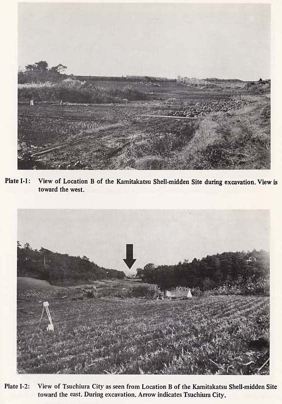
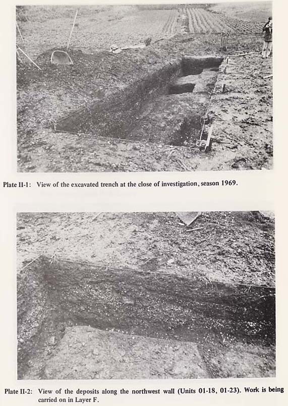
Kamitakatsu Shell-midden Site is a general name given to five areas of scattered molluscan shells which are observed on the flat plateau of the twenty to twenty-two meter terrace and on the slope around the plateau (Fig. 4). In other words, Kamitakatsu Site in its strict sense is these five locations of scattered shells. Not only shells but also potsherds and bone fragments are scattered in these areas. These five locations are different shapes and sizes in ground plan, but they are all located on the edge around the plateau. The first record of the Kamitakatsu Site was made quite long ago; there is a paper dated in 1900 on the remains obtained from this site (Numata, 1900). However, it is not an excavation report but rather a short description of the surface materials. The first excavation was carried out in the 1930's by the Ohyama Prehistoric Institute, but all its records were burned during the Second World War. Then this site was not heard of until in 1950 the Archaeological Institute of Keio University started a series of systematic investigations there. The present examination paid special attention on the chronological study of the Jomon pottery types in the Kanto region, and, at the same time, by using various pottery types as the time scale, it also aimed at analyzing the sequential changes of the subsistence activities of the Jomon people viz-a-viz environmental factors. Investigations were carried out in 1950, 1968 and 1969. The results of the 1950 investigation have already been reported (Hirano et al, 1954), and preliminary reports have been published on the following two seasons (Keio Archaeological Society, 1970, Komiya, 1970). 2. Reason for the Site Selection and Excavation PlanThe purpose of the present investigation was to examine the relation between the Kamitakatsu shell-midden people and the contemporary environment. For this purpose it was necessary to study the artifacts and the numerous faunal and floral remains which could only be obtained through excavation of the shell-midden. The site consists of five locations of shell-midden deposits. Among them Locality A has been systematically investigated by the Keio Archaeological Institute since 1950, and for this reason it was omitted from the present investigation. Among the remaining localities, Locality B was selected for the present study after a preliminary survey carried out in the following way: First, the earth surface was observed as to whether the original features had been disturbed by road and/or field construction. Along with this a boring survey was made to examine the depth and condition of the deposits. As a result, it was found that in Location C, D, and E numerous large potsherds were scattered on the surface and that the deposits were relatively thin and soft. On the other hand, in Location B the deposits seemed relatively undisturbed and thick, so it was chosen for the present investigation. The investigation in 1969 was carried out as a preliminary excavation in order to recover fundamental information essential to succeeding investigations. The purpose was first to determine the stratigraphy, clarify the assemblage of remains according to the each stratum, and establish the cultural stratigraphy based on these data. It also aimed at determining the distribution of the shell-midden deposits of location B. For this purpose a two by eight meter trench was excavated in Site Grid D4 (Fig. 4, Plate II: 1). Furthermore, this trench was divided into four smaller units (each two by two meters), and each unit was used as the smallest unit for study of the vertical and horizontal distribution of deposits and remains. The size (two by two meters) of the single units coincides with that of the Keio Archaeological Institute.
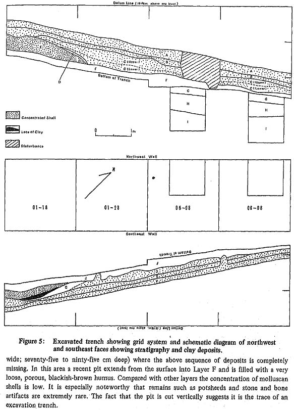
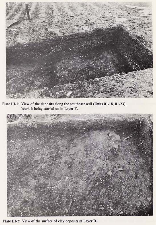
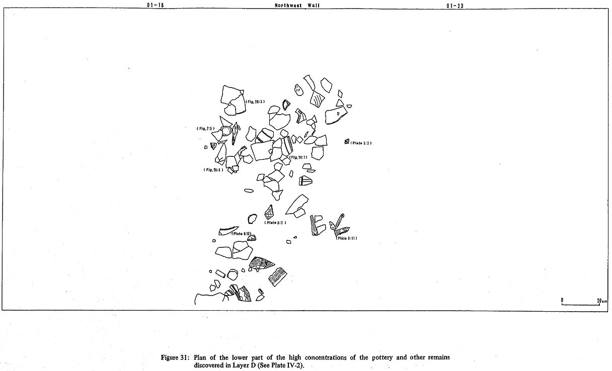
3. General Stratigraphy of the Excavated AreaAfter the excavation the sequence of deposits was divided into nine geological layers according to sedimentary facies and soil colors. Of these, only Layers A-E were dug completely throughout the excavated area. Three other Layers (G-I) were exposed only in pits (one by one meter) dug along the northwestern wall of Units 06-03 and 06-08 (Plate II:1). Layer F was excavated only in parts of Units 01-18, 01-23. The following is a description of the general features of these eight layers (Fig. 5, Plates II, III, IV).
|